Maps of existing wells in the Upper Trinity Groundwater Conservation District.
Resources
Powerpoint on GMA 8 and DFCs
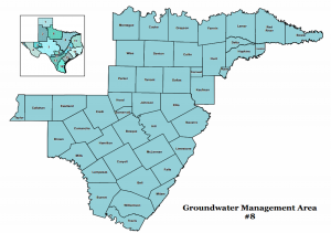
GMA 8 Boundaries
![GMA8boundaries](https://uppertrinitygcd.com/wp-content/uploads/2016/04/GMA8boundaries-300x211.png)
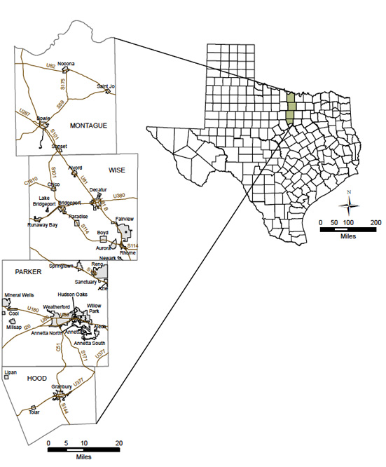
Locations and boundaries of the District
![Locations and boundaries of the district.](https://uppertrinitygcd.com/wp-content/uploads/2014/12/boundry.jpg)
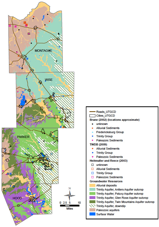
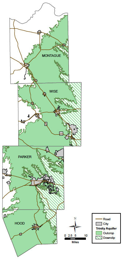
Outcrop and subcrop of the Trinity Aquifer in the District
![Outcrop and Subcrop of the Trinity Aquifer in the District](https://uppertrinitygcd.com/wp-content/uploads/2014/12/outcrop.jpg)
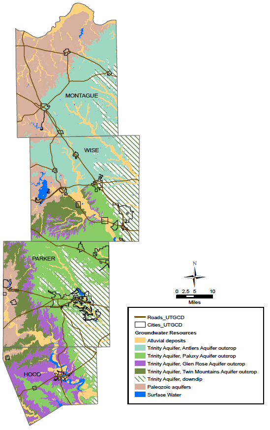
Groundwater resources in the District
![Groundwater Resources in the district](https://uppertrinitygcd.com/wp-content/uploads/2014/12/resources.jpg)
Documented Springs in the District
![documented](https://uppertrinitygcd.com/wp-content/uploads/2014/12/documented.jpg)